Showing posts with label History. Show all posts

Wednesday, 15 October 2025

Foyle Style

An unexpected morning to myself last weekend turned into a perfect (and rare!) opportunity for some "me time", especially as Storm Amy laid waste to my plans to mow the lawn (so unfortunate!)  Instead I sojourned back to 1942 to watch an American "invasion" take place on the streets of Sussex, courtesy of Foyle's War.  

Yes, Mum will like this blog.

Now Foyle's War is exceptional autumn viewing, a flavourful mix of history and drama, with its intriguing plots that often land somewhere in the grey area, testing the viewers' sense of morality, of right-and-wrong.  To give a couple of examples from previous episodes, should a Nazi sympathiser be allowed to voice his opinion in a free and democratic society?  Is it ok that a murderer is allowed to go free, because his role is essential to the war effort?  This is a programme that runs deeper than a period murder mystery - it challenges us to clarify our feelings and confront our contradictions, and it exposes the truth - that right-and-wrong is never as clear-cut as black-and-white.

I digress slightly, but I think my point is that the lessons of Foyle's War are incredibly pertinent today, as our social media ages rushes to draw clear distinctions on any topic, without consideration of differing viewpoints or lived experiences.  Have a quick browse on X (the artist formerly known as Twitter) and you'll probably agree with me that we could all learn a bit from Foyle's War.

There's something else going on with Foyle, though, and beneath the complexities of the writing, there sits a central character who epitomises standards, and embodies the idea of a role model.  Detective Chief Superintendent Christopher Foyle is thoughtful, eloquent, determined, and has a strong moral compass which he uses to govern his behaviour, upholding the law and challenging corruption, often from above and in situations where it would be easier - and personally safer - to leave well alone.  He is loyal, but not to the point where he wouldn't take a friend to task if necessary, and he is thorough and tenacious, whilst simultaneously understanding the nuances of life, particularly in a time of war.  He speaks honestly to friends, truth to power, and doesn't compromise his integrity for anyone.

Then there's the clothes.  The three-piece, pure wool suit with the peak lapel jacket, most likely worn with a red silk tie (in reality probably toxic rayon, for silk was not widely available in wartime Britain, yet Foyle's ties are certainly not of knitted wool), and of course a camel wool overcoat and fedora (sometimes matching a blue suit, other times khaki). 

It is, in effect, the perfect outfit, but one I am unlikely to emulate, firstly because I am not Michael Kitchen; and secondly because, although I own suits, they are not day-to-day wear for me and my lifestyle.  So instead, I've created a couple of outfits inspired by Foyle and wartime style, but which give me scope to wear out and about in a modern way.

1. Foyle "Lite".  This is an outfit I can get on board with.  I've chosen my air force blue herringbone jacket and matching waistcoat here, a lovely two-piece that is amongst my favourites.  This sits over a plain white shirt and a tie that has some detailing, but hopefully not too loud.  For trousers, I've used navy cords, but would easily wear this with brown or biscuit; and on top, my trusty navy fedora.  I've also popped on my Grandad's Air Training Corps lapel pin.


2. The Airman.  I've been playing with this outfit for a while.  The jumper is reminiscent of the RAF cadets, but I've gone in a more comfortable direction below, again using my navy cords for the season.  Slung over the top is my Joe Brown's "military" jacket.  There's a relatively simple, almost austere feel to this look to this outfit that I quite like.  Finished off with this lovely RAF shoulder bag that only recently fell into my possession.


3. The Flying Tiger.  The biscuit button-down Oxford shirt is a classic piece in a men's wardrobe, paired with khaki cords.  On top, I've gone for this inexpensive olive chore shirt, onto which I have ironed a couple of patches to make this really individual.  There's the US Air Force star on the sleeve, and on the left breast pocket a little tribute to the Flying Tigers, an incredible group of American volunteer pilots who, under the command of Claire Lee Chennault, defended the skies of China from the Empire of Japan, in one of the war's most extraordinary stories.  Worth looking that man up, if you get a moment.


So, a little bit of the wartime spirit coming through here, but with enough style - I think - to wear out in the everyday.  Hopefully the man below would approve... or is he simply laughing at me?

Wednesday, 1 October 2025

Viroconium Cornoviorum

Haha, fooled you! Did you really think I was going to blog about the archaeology of Shropshire and not mention the Roman city at Wroxeter?  Come on now... this is me!

Pictured below is "The Old Work".  And just behind that is a pile of Roman ruins.


Seriously though, the Old Work is one of the stand-out ruins of Roman Britain.  In its heyday it was the north wall of the bathhouse, specifically the frigidarium or "cold room", one of the many rooms set aside for public bathing in the town centre.  Every major Roman town had a public bathhouse, but few survive to the same extent of Wroxeter (let's exclude the complicated situation at Bath from this statement!)  

It is also a place to which I have been trying to get for a number of years.  When I was a student (yes, that long ago), I put a ring around the three Roman places I most wanted to see - Verulamium; the Wall; and Wroxeter.  So it is with a touch of emotion that I allowed my hand to rest on the ruined wall here, because I've completed something of a long-held ambition, and I want to savour the moment and affirm the special memory I've created, when the rhythm of my heartbeat chimed with the pulse of this very ancient, very special place. Lovely!

Tuesday, 30 September 2025

Floreat Salopia!

I'm back from the annual archaeology "residential" with Tristan, a weekend in which we fill every waking hour on all subjects historical.  It's always a great time, just two guys jumping in a car and heading north (for it is always north from here), covering all manner of subjects as we go - guy stuff; the state of the world; dad insights; sartorial thoughts; and, almost obsessively, English history.

On this latter point, Shropshire has it in spades, from prehistoric monuments to great church spires, Roman ruins to medieval monasteries.  There's too much to pack into one blog post, so let's hone in on three treasures t\upon which we stumbled this weekend, and three that should whizz to the top of your sightseeing list.

Old Oswestry Hillfort
Somewhat confusedly styled as the "Stonehenge of the Iron Age" (what the hell does that mean?!?), this one is really out on a limb, mere miles from the Welsh border, and the foreboding hills of Denbighshire.  It is, however, a rather splendid place - once a site of some status, the hillfort sits on the boundary of two Iron Age tribes, belonging either to the Ordovices, or to the Cornovii - or possibly changing hands over hundreds of years.  Significant earthwork defences surround the entire site, but are more complex towards the west (that is, the side facing the Ordovices), so I suspect this at least ended up as a Cornovii stronghold.  Within the ramparts, a large number of black sheep were peacefully grazing, a flock that is afforded one of the finest views that England has to offer, with the Welsh mountains punctuating the horizon to the west, the lowlands of Shropshire stretching out east.  In the Iron Age, the centre was home to a number of wattle-and-daub roundhouses, with pottery remains from as far away as Wiltshire suggesting that this was a place of extensive trade and power.  Prepare yourself for a drive and go for a visit - it's British prehistory at its finest.


Buildwas Abbey
Low-slung in the valley of the ever-present River Severn, this monastery was founded in 1135 as a Savignac house, before being absorbed into the Cistercian order by 1147 at the latest.  We have arrived here from nearby Wenlock Priory, a Cluniac house, and the contrast between the two could not be more stark.  Where Wenlock enjoyed fine carvings and demonstrations of artistic wealth, Buildwas is sparse, uncompromising in its simplicity, typically Cistercian in its deliberate austerity.  Yet the atmosphere that lingers here is palpable, a thick and misty presence that hangs in the airs, not unpleasant, not particularly spooky, but certainly noticeable.  The abbey was financially broke by 1342; completely broken by the Black Death in 1349; and wrecked by Welsh raiders in 1350, events from which it never really recovered. It was condemned in 1521 as "deficient in every respect", before finally being dissolved as a lesser monastery in 1536, during the Dissolution of the Monasteries.  For us, the poverty and the ruination sees the church remain in its original condition, providing some of the best-preserved Cistercian church ruins from anywhere in England, and a real window into a piece of the past.


Church of St Mary the Virgin, Shrewsbury
Speaking of windows, here's a reason to come to Shrewsbury (as if another were needed, for it is a lovely town!) I will eschew all description of the Medieval church, which was hosting a beer festival (!), and head straight for the exceptional east window, which contains a depiction of the Jesse Tree, said to have been made in Shrewsbury and transported here-and-there, before ending up at its current church in 1792.  Much of the glass - and this is the really amazing thing - is Medieval, dating from between 1327 to 1353, the very highest point of the English Gothic.  It is an extraordinary piece of art, really a national treasure, and to gaze upon it is to glimpse English history at its most stunning.  One can identify the ancestors and descendants of Jesse, the father of David, whose line can traditionally be traced down to Christ.  Extra points if anybody spots Edward III, the only royal figure on the window, who of course happened to be reigning monarch at the time of this window's creation - so we also see that playing politics is nothing new!  Interesting aside - the church spire here is thought to be the third-tallest spire in England, though I can think of plenty others that may claim that crown - can you?


A great trip to a distinctly beautiful county, a fair old drive from South Devon, but worth every mile, for Shropshire has a rich heritage, and one that it has been a pleasure to explore.  May Salop flourish indeed!

Monday, 14 June 2021

The Archaeology Files - Hod Hill

Date of visit: 1 March 2020
Location: 3 miles north west of Blandford Forum, Dorset
Time period: Iron Age, c.800 BC to AD 43 (incorporating later Roman fortifications)
Type of site: Iron Age hillfort with Roman earthwork remains
Photos: Hod Hill site visit photo album 

Hod Hill sits, like its twin hillfort Hambledon Hill, in the peaceful Dorset countryside, commanding a significant vista over its immediate hinterland.  On first impressions, the hill must be high, for it is an exasperating climb to its 68-metre (223 feet) summit, made all-the-harder by thick, deep mud, which clings to your boots, and makes each step a struggle.  I've come here on an early March day, following on from a tremendously wet winter, and many of the surrounding fields are flooded.  Of course, weather like this would not have bothered the original inhabitants of the hillfort, who would have had little need to regularly traverse the steep slopes, but for the amateur archaeologist and enthusiastic visitor, the earthen trackway leading up to the hillfort entrance makes for a perilous expedition.

Aerial photo of Hod Hill, showing the extent of the Roman fort in the north west corner of the hillfort

The literature will tell you that Hod Hill, at 22 hectares, is the largest hillfort in Dorset.  I suppose they've done the maths on this, but I can't say it feels anywhere near the size of Maiden Castle, as I trudge across its sheep-filled interior.  Maybe it's because the site is more square in shape, making up in width what it lacks in length, compared to its famous Dorchester sister.  Hod Hill follows the general trend of all hillforts, being occupied by the fifth century BC (possibly earlier) and growing in population so that by the first century BC, its interior would have been covered by possibly hundreds of round huts, laid out in a rudimentary grid system.  Here lived people of the Durotrige tribe, who inhabited what we now call Dorset and were, in my opinion, Britain's master hillfort builders.  There are some mighty earth ramparts around the perimeter of this hillfort, which given the elevation of the site, is perhaps surprising, and suggests a paranoia amongst the population - which, to be fair, turned out to be entirely justified.  I'm not going to discount the idea that some of the purpose of the ramparts was to discourage livestock from escaping - the steep hill here would make it very difficult and time-consuming to recapture escaped animals.

Hod Hill - external ditch and ramparts

Most hillforts appear to have been abandoned before the Roman invasion of AD 43, but at Hod Hill there is evidence of some resistance to the Roman Army, where eleven Roman ballista bolts have been recovered, apparently trained on one high-status round house, which is sometimes known as the "Chieftain's hut".  It brings an uneasy feeling to mind, for here at Hod is the real impact of the Roman invasion, at least for those who resisted the invading force - men, woman, children and families doing their best to defend themselves and their home against a vastly superior military force which, after all, appeared on these shores without invitation.  So far, no evidence has been discovered for a big massacre at Hod Hill, but archaeological investigation does show that there was a rapid abandonment of round houses when the Romans arrived - so perhaps the population surrendered and were allowed to leave, but only in a hurry.

So if this is the case, why were they made to leave so quickly?  It was the responsibility of the Roman Legio II Augusta, under the control of the future Emperor Vespasian, to pacify the Durotriges and seize the hillforts in this part of the country.  After Hod Hill was pacified and its occupants removed, the legion saw in the site an excellent strategic point, most likely due to its proximity to the River Stour, a trading route and potential military supply line.  Consequentially, a fort was built within the parameter of the hillfort, centred on the north west corner of the site, to house a Legionary cohort (of around 500 men) and cavalry detachment (about 250 men - but imagine getting horses up-and-down this hill.)  What makes this particularly fascinating is that the earthworks associated with the Roman fort still survive very clearly, especially in aerial photographs - although I found the site harder to interpret on the ground.  As it happens, the Legionary cohort didn't stay here very long, abandoning the site in AD 51 as military priorities changed, and Legio II Augusta turned its sights further west, to the Dumnonii tribe, whose capital sat at what we now call Exeter.

View from within the Roman section of the hillfort, looking east towards the Roman fortification - see below for photo location 

Plan of Hod Hill showing location of above photo (source: British History online)

At Hod Hill, the Durotriges left behind one of the iconic archaeological sites in the landscape of the south west.  I talk fairly frequently about the atmosphere you can sometimes perceive in ancient places, and Hod Hill is another one of these.  On my visit, the weather rolled in quickly, dusk took an early turn, and it started to rain when I was at the farthest and most exposed part of the hillfort.  It felt eerie and almost uncomfortable at that point, like a sudden bout of agoraphobia, mixed with a general perception that I was on foreign ground, somewhere I wasn't supposed to be.  Maybe it's just because I was the only person up there, or perhaps the weight of ancientness and history somehow got inside of me, but once I felt it, I was fairly quick to leave.  Regardless of this, Hod Hill is a unique place, and having the chance to explore the site has fulfilled a longing that's been smouldered in me for many years.

Monday, 31 May 2021

The Archaeology Files - Verulamium Roman town (St Albans)

Date of visit: 7 March 2020
Location: South west of St Albans city centre
Time period: Roman, AD 43 to AD 410 (incorporating some earlier Iron Age remains)
Type of site: Roman town remains
Photos: Verulamium site visit photo album 

I've wanted to visit Verulamium for a number of years, so this was a very exciting trip, taking place only a few days before the first COVID-19 lockdown was announced.  

Verulamium occupied something of a unique spot in the administration of Roman Britain - more important than the regional civitas capitals, but not of high enough status to be awarded the title of colonia, Verulamium was a instead designated municipium, the second-highest ranking of Roman town, and the only example in Britain.  This status was awarded in AD 50, and gave the inhabitants of the town a higher legal status than those of other settlements - citizens of municipia possessed 'Latin Rights', a sort-of lesser citizenship status, and were entrusted with a certain amount of self-governance.

Why was Verulamium given this unique status?  Well, we know that Verulamium existed as an established settlement before the Roman invasion, where it was known as Verlamion and was the capital of the Catuvellauni people.  It appears that Verlamion grew into an important trading centre for iron ore, and that is was part of an established trade route with Roman Gaul, prior to the Roman invasion of Britain.  After the invasion, the tribe was friendly towards Roman rule, thus enabling the invading army to make haste in heading north and west - indeed, when the Roman army built the famous Watling Street shortly after the invasion, the course of the road ran slap-bang through Verulamium, enabling the very swift movement of troops.  The Catuvellauni were adopted as something of a "client kingdom" by the Romans, allowed to do things their own way (provided it complemented Roman ambitions) - and for this reason, Verulamium in the early days of Roman rule was not particularly Roman in appearance, although inhabitants were using high quality Roman pottery and metal works.  So I think the award of municipium status comes from the pre-Roman importance of the site, its clout as a trading centre, and perhaps as a reward to the people of the town for their cooperation in those early days of empire.

A decade later, the town fell victim to the Boudican Revolt - probably because of its attitudes to Roman rule and culture.  As with Colchester and London, archaeologists here have found burnt layers consistent with the razing of buildings, but in an ironic way, the destruction wrought by the revolt gave the Roman authorities the opportunity to start the town afresh, so that the Iron Age layout was removed and replaced with a more conventional Roman street system.  This included the construction of the usual Roman town buildings - a forum, basilica, bathhouse and theatre.  An inscription from the forum at Verulamium, dating from either AD 79 or AD 81, was discovered during works on in a school yard in 1955, near to the north-east entrance of the forum and basilica.  This is notable for mentioning Gnaeus Julius Agricola, the Governor of Britain (AD 77-84), whose son-in-law Tacitus wrote his biography, a fascinating work that has been largely relied upon in our understanding of the earlier days of Roman rule.  The reconstructed inscription hangs in the excellent Verulamium Museum, and is translated as follows:

For the Emperor Titus Caesar Vespasian Augustus, son of the deified Vespasian, Pontifex Maximus, in the ninth year of tribunician power, acclaimed Imperator fifteen times, having been consul seven times, designated consul for an eighth time, censor, Father of the Fatherland, and to Caesar Domitian, son of the deified Vespasian, having been consul six times, designated consul for a seventh term, Prince of Youth, and member of all the priestly brotherhoods, when Gnaeus Julius Agricola was legate of the emperor with pro-praetorian power, the Verulamium basilica was adorned.

Inscription in the Verulamium Museum
Interesting side note: the reference to Domitian was defaced on this inscription and many others around the Empire, after a damnation memoriae was pronounced on him in AD 96 (a damnation memoriae was essentially an instruction to forget somebody, to strike their name from public record, to wipe them out of history.) 

In the heyday of the Romano-British period that followed the Boudican Revolt, Verulamium flourished, and was the third-largest settlement in Britain.  Nowadays, the town's major archaeological focal-point is the Roman theatre, which must surely count as some of the country's finest Roman remains.  As far as we are aware, Verulamium theatre is unique in Britain, for it is the only example of its kind to have a stage, as opposed to an amphitheatre.  The theatre was built in around AD 140, and used for a variety of purposes, from religious processions, dancing, wrestling, armed combat, readings and wild beast shows.  Archaeologists have determined that the theatre was expanded in the AD 180s, and that by AD 300 it could seat 2,000 spectators. 

Verulamium theatre remains - amongst the finest Roman remains in the country

Reconstruction of Verulamium theatre

Beyond the walls of the theatre, archaeological excavations have uncovered a row of shop foundations, which open out onto Watling Street itself.  The shops seem to be in the classic Romano-British style, sometimes known as "strip shops", with a shop front and storage and sleeping quarters towards the back.  Excavations have revealed broken crucibles and waste metal, so these shops appear to have been used by metal workers and blacksmiths.  The site surrounding the theatre was also home to a large townhouse, which contained a hypocaust (underground heating system) and underground shrine.

The higher-status Roman townhouse

Strip shop remains - Watling Street lies directly behind
The public Verulamium Park also contains undercover Roman mosaic and hypocaust remains, which were unfortunately closed on the day of my visit.  The park itself is a large and beautiful green space, dotted with the odd fragment of original Roman wall (frustratingly I have misplaced my photo of the wall, so the below image is courtesy of English Heritage.)

Part of the Roman wall in Verulamium Park (source: English Heritage)

Finally, a note on Verulamium Museum, a rarity in this country for being solely focussed on the town's Roman history.  The museum houses one of the best collections of Romano-British mosaics anywhere in the country, including the amazing "Sea God" mosaic (AD 160-190), a fine piece of work that must have belonged to an elite person.  There are also an awful lot of artefacts taken from Verulamium and the surrounding countryside, much of which hints at a society which adopted Roman culture with some ease.

The Sea God mosaic

Sunday, 2 May 2021

The Archaeology Files - Trethevy Quoit

Date of visit: 25 April 2021
Location: East of the village of St Cleer, 2 miles north of Liskeard, Cornwall
Time period: Neolithic, 4,000 BC to 2,500 BC
Type of site: A well-preserved Neolithic portal dolmen burial chamber
Photos: Trethevy Quoit site visit photo album 

Arriving at the five-space designated car park, the first thing you notice on a visit here are the signs indicating a World Heritage Site, not because of prehistoric monuments, but because of the mining landscape.  The reminder of Cornwall's mining heritage is everywhere, dotted about the landscape in all directions.  It's not the point of this site visit, but it is an interesting aside, and one that connects a more modern age with our ancient ancestors, through distinctive exploitation of the landscape.  I wonder what heed the miners paid monuments such as Trethevy Quoit, and I wonder if it had any influence on their traditions and superstitions.

Cornwall's rich mining heritage is evident all around, on a visit to Trethevy Quoit

Trethevy Quoit is a very nicely-preserved portal dolmen, a type of monument quite specific to Cornwall (and more usually, western Cornwall - Trethevy Quoit is an anomaly, being so far east), dating to the early or middle Neolithic (3500-2500BC.)  These structures are largely considered to be tombs, although it is not certain if this was their intended use - quite possibly they were multipurpose, or used in ceremony or worship.  

Trethevy Quoit.  Note the slightly raised ground around the base of the monument - possibly the remains of a mound or cairn which once covered the structure

The structure consists of five standing stones, topped by a huge capstone (estimated to weigh 10.5 tons), which slopes downwards from back-to-front at a much steeper angle than was originally designed.  This is because one of the supporting granite stones - the most westerly - collapsed at some point in the past, and now lies within the chamber itself.  Had this stone continued to stand, the capstone would rest roughly horizontally on top.  The structure stands 2.7 metres (9 feet) tall, and at its highest point, the capstone has a hole - possibly manmade - with one suggestion being that it was used for astronomical observations.  It is thought that the chamber was originally covered by a mound or cairn - you can see this in the slight remains of a low mound at the sides and back of the structure, but not at the entrance.  Local tradition states that the stones were set up by a giant, with the hole in the capstone being made by the giant's thumb, in order to lift the monument into its present position.  It is from this legend that the site gets an alternative name, The Giant's House.

A sketch of Trethevy Quoit from 1848 (artist unknown)

My overriding impression at Trethevy Quoit is one of awe, in how people managed to move such enormous hulks of granite - especially the raising of the capstone, and at a time when calories were so precious.  I believe this boils down to two aspects - firstly, a community must have had enough sustenance, and been confident in the supply of that sustenance, to undertake this project.  Second, a community must have had a complex level of organisation.  Simply put, once agriculture was adopted at the onset of the Neolithic, human communities evolved to become more sedentary and organised.  The supply of food was more reliable compared to the hunter-gatherer way of life, which in turn meant that communities started to lay down roots, explore myths, legends and spirituality associated with their immediate landscape, and began building monuments on a scale previously inaccessible.  Of course, none of this takes away from the amazing manpower required to lift such huge stones without the use of modern machinery - we simply couldn't do it today.

In November 2017, Trethevy Quoit was added to Historic England's Heritage at Risk Register, due to the damage previously caused by fencing and increasing erosion by livestock.  Nowadays, the site is fenced off in its own enclosure.


Tuesday, 27 April 2021

The Archaeology Files - Wayland's Smithy

Date of visit: 6 March 2020
Location: 7 miles east of Swindon, between the villages of Ashbury and Compton Beauchamp, Oxfordshire
Time period: Neolithic, 4,000 BC to 2,500 BC
Type of site: A well-preserved Neolithic long barrow of the Severn-Cotswolds tradition

On a crisp and misty March morning, you get a sense of the spiritual about Wayland's Smithy.  The Neolithic long barrow is accessible via a two-mile walk across big, flat open fields.  It's easy to think that nothing has changed since this monument was first created, for there seems to be an old and other-worldly atmosphere about the place, a far cry from the disruption of the modern world.

Wayland's Smithy is a chambered long barrow, built during the early Neolithic period.  Long barrow construction was widespread across Britain and Europe at this time, although Wayland's Smithy belongs to a regional variant of long barrow style, the Severn-Cotswold group, of which is is one of the best surviving examples.  The long barrow runs 55m in length, 14m wide, with a peristalith edging of slabs.

Entrance Wayland's smithy long barrow, with two of the four sarsen stones in full view

The tomb here actually forms two phases.  The first monument was made largely of wood with some stone, and was built between 3590 and 3550 BC, eventually housing a single crouched burial, with the further remains of 14 people scattered in front of this.  This tomb consisted of a paved stone floor with two large posts at either end, thought to support a timber facade.  There was then a period of disuse, during which time the structure was covered by an oval mound of chalk and earth, signalling the closure of the barrow.

After around 100 years of disuse (possibly as little as 50 years), a larger barrow was built directly on top of this structure using stone, and probably twice the size of the original, between 3460 and 3400 BC.  This is the structure that we see today.  This tomb contained two transept chambers and a terminal chamber, along with the long entrance chamber - forming a rough cross shape.  Today, the entrance is guarded by four sarsen stones (originally six), which were returned to their upright positions during archaeological excavation in 1962.  Within this later tomb, archaeologists uncovered the jumbled remains of seven adults and one child.

Entrance into the chamber area 

It is interesting that the transition from timber to stone at Wayland's Smithy took place over a relatively short period.  It's also worth noting that the burials in the second tomb were late in use, compared with burials elsewhere - the famous long barrow at West Kennet had seen burials in stone tombs of this style at least 200 years earlier.  I'm particularly interested in why the long barrow was re-opened after a period of closure, which must have spanned enough time for the use of the original to be outside living memory.  I would suggest that the site had a symbolism and significance that had been collectively remembered, a legend passed down the generations which kept ancestral ties to the site intact, and made Wayland's Smithy an important one in the culture, heritage and tradition of the people.

Finally, a note on the unusual name of this long barrow - the name of Wayland's Smithy appears to come from a Saxon Charter of AD 955, which refers to the site as "Weland's Smithy".  It is suggested that the site takes its name because it was once thought to have been the home of Wayland, the Saxon god of metal working.  There is also a local tradition stating that if you were to leave your horse tethered to the long barrow along with a small coin, an invisible elvin smith would magically re-shoe your horse while you were away.

Wider view of Wayland's Smithy

Wednesday, 25 November 2020

Makin' mosaics

Lockdown (the second) has given us all a chance to slow down and look at things in a more leisurely way, and for me it's taken me back into  some of my travel photos from my past.  In 2008 I interrailed around Europe, visiting several  amazing cities and fabulous sites along the way.  On one sunny morning in Rome, I took the Metro out of the city in the direction of Ostia.  Something incredible happened that day -  though descended underground in blazing blue-skied sunshine, our train emerged 20 minutes later into a cacophonous thunder storm, and some of the heaviest rain I've ever seen.  Flashes of lightning and howling winds gave an apocalyptic feel - and I made an about-turn and caught the very next train back to Rome.  Incidentally it was on exiting Rome's Porta S. Paolo station that I ran into the Pyramid of Caius Cestius.  "A pyramid in Rome?!?", I hear you scream?  Well, yes, actually.  Built between 18-12 BC, and thought to be based on the pyramids of Nubia (which had been attacked by Rome a decade earlier), the structure is the tomb of the aforementioned Caius Cestius, who may have been a Roman general on that military campaign.  You can only imagine how exotic it must have looked 2,000 years ago.  

Anyway, I digress.  Take two, and the following day my train did emerge in more palatable weather, delivering me at Ostia Antica, the remains of an ancient Roman city, the major port of Rome itself.   In its heyday it sat at the very mouth of the Tiber, although two millennia of silt have had the final say, and the remains of the town are now a good two miles inland.  British archaeology is my true calling, but Ostia Antica must stand alone as the singular greatest archaeological site I've ever visited.  Now, granted I haven't yet been to Pompeii, but I defy even that famous city to impress me more.  It wasn't just that the site was so amazingly preserved, with its street system and buildings, its theatre and its mosaics - it was that on this day, I had the whole place virtually to myself, the town mine to wander and explore to my heart's content.  And I did. I spent all day there.  They couldn't get me out of the place.

One of the things that most stuck with me at Ostia was the abundance of mosaics, both on walls and floors.  And even more amazing to me was that, with a few exceptions, they didn't even bother to fence them off - you could walk on actual 2,000-year-old Roman mosaics of the highest quality.  Now as someone from Britain who sees even the most basic Roman mosaics placed behind glass in order to preserve them (Dorchester literally built a house over theirs) this was something of a revelation, although I couldn't bring myself to trot over them, but diligently marvelled from the sidelines.  

There are many - many - mosaics at Ostia, but my favourite depicts scenes of great importance to the city - fishing, shipping, and trade.  Far beyond anything else, they've stuck with me, and are probably the first thing I think of when I think of Rome (sorry, Colosseum!)  I forget, and cannot find any authoritative source to tell me, exactly where this mosaic was situated - could it have been a market, or a merchant's place of business?  The amphora clearly suggests trade to me, and it's an activity taking place with northern Africa (the palms are the giveaway - palms aren't native to Italy).  Whatever your interpretation, they're just stunning in my opinion.


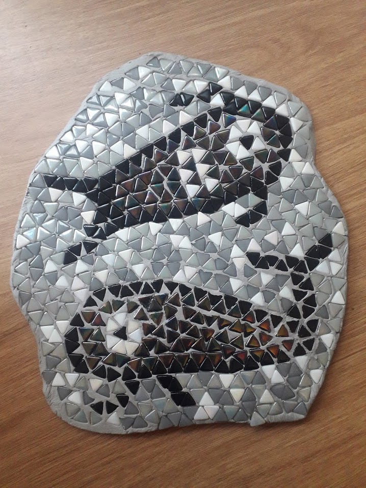
So stunning, in fact, that over lockdown #2 I decided to grab a slab of air-drying clay, a big bag of glass pieces, and attempt my own version for the garden.  Now, I know it's a shadow of the original, but in a weird and wonderful way it ties in with our location - the Roman Army are known to have camped at Milber Down hillfort just up the road from us, and I have often sat in the garden imagining Imperial soldiers scrabbling down the slopes of what now forms our decking.  Fanciful maybe, but the mere fact that the same people who camped so close to here were also trading with Egypt across the Mediterranean should make us all marvel and the extent of the Roman Empire.

You can see all my photos from Ostia Antica in my photo album.  So that's how my lockdown's been going - what home adventures have you been on? 

Monday, 28 September 2020

Wonderful Winchester

There's something I like about Winchester, and I instantly know what it is - the city is just so historic.  Is there anywhere in England with more of a claim on English history than the Hampshire county town?  I don't think so - the surrounding countryside is home to at least three Iron Age hillforts, including the very near St Catherine's Hill, from whence the Belgae tribe eventually left the slopes and formed the first town-like settlement here, likely known as Wenta, which the Romans adapted to Venta Belgarum ("Venta of the Belgae".)  There's not much Roman remains still visible in the city, for the sheer reason that after the Roman withdrawal, Winchester continued to serve as an urban centre (albeit on a reduced scale) thus developing the city ever forwards.  Winchester famously became the Capital of Wessex under Alfred The Great in the 800s, who obliterated what remained of the Roman street system as he reorganised the city to counter the Viking threat.  From here, it just stayed, a permanent English fixture, important and influential.  After the Norman Conquest, the Bishop of Winchester (one Walkelin) began work on a new cathedral to replace the Old Minster that had served as cathedral since 642, eventually creating one of the largest cathedrals in Europe.  At its consecration in 1093, the Annals of Winchester tell us that "in the presence of almost all the bishops and abbots of England, the monks came with the highest exultation and glory from the old minster to the new one; on the Feast of St Swithun they went in procession from the new minster to the old one and brought thence St Swithun's shrine and placed it with honour in the new buildings, and on the following day Walkelin's men first begun to pull the old minster."  Much of Walkelin's work survives, nearly a thousand years later.  It just doesn't get more historic than this.


Now for my sins, having family connections to this area and having visited Winchester so many times in my life, I've never actually been into the cathedral before.  Until now.  The cathedral will probably feature on my blog series "The Archaeology Files" at some point, so I'm not going to delve too deeply on this today - suffice to say, it's another stunning and quite moving place to be, and whilst the tourists gather like sheep around Jane Austen's tomb, I'm delighted to have found the memorial to Devonian General Sir Henry Redvers Buller (although his final resting place is Crediton Church), even if he gets a bad rap nowadays for daring to have Victorian ideas during the Victorian period (gasps!)  Elsewhere in Winchester Cathedral is the aforementioned shrine to St Swithun, Anglo-Saxon Bishop of Winchester and the world's most famous weather forecaster.  I love to see an old shrine in an English cathedral, and St Swithun's is certainly rather charming.


With apologies to Lizzie, our trip to Winchester descends into a proper history tour, as we follow the high street towards the Great Hall, to take in the famous Round Table.  The Great Hall dates back to the 13th century, and was once part of a bigger castle complex, the majority of which has now been sadly removed.  The Great Hall itself was built by Henry III, and has an interesting history of justice - Sir Walter Raleigh went on trial for treason here, conducting his own defence in the process; the Bloody Assizes started here, and amongst others saw the trial of Lady Alice Lisle, shockingly sentenced to death on a false charge of harbouring fugitives (Westcountry folk are all too familiar with Judge Jeffreys, the "Hanging Judge", whose shocking version of justice puts him firmly in the seventh circle of hell); and in more recent times, the Great Hall played host to an IRA trial after one person died, and 200 were injured, when two car bombs were set off outside the Old Bailey and Scotland Yard.  That November day in 1973 saw a heavy security presence, with all doors to the Hall bolted, and 15 police officers surrounding the accused.  I prefer it on our visit - calm, peaceful and basking in its own glory.

Of course, dominating the beautiful space is the Round Table itself, thought to have been commissioned by Edward I, who was said to be an Arthurian enthusiast.  The table is a brilliant piece of English history, and is one of my favourites (I bought a fridge magnet and a coaster), but what struck me most was learning how Henry VIII used it for propaganda.  Henry visited Winchester for the first time in 1516, and within days had issued a writ ordering "the repair of the Great Hall at Winchester and the Round table there."  He clearly saw an opportunity - on having it restored and repainted, Henry saw fit to add an enormous Tudor rose into the centre of the table, and had the image of King Arthur painted very much in his own likeness.  When it was finished, Henry brought Charles V, the Holy Roman Emperor, to Winchester to take a look - it is said that the table reminded Charles of Henry's claim to Arthur's inheritance, and his true links to the ancient British throne.  It's a brilliant example of how English history was written by the victors.

Our day in Winchester comes to an end with a walk through Wolvsey Castle grounds and a stroll along the Itchen.  Even the water here is historic - the Vikings famously sailed up here in 860 to besiege the town in what became known as the Battle of Winchester.  Considering I haven't been here in 13 years, I'm amazed at how well I remembered how to navigate us around, but I suppose its easy in a city like this, where everything is ancient, and little has changed in the course of my lifetime, if not for at least 500 years.  It's a timelessness that's so rare in general, and yet so abundant here, and it makes Winchester a real jewel in the crown of English history. 

Friday, 25 September 2020

The enduring nature of the New Forest

A much-needed week off for the both of us saw us pack up the car and head east, through lovely Dorset and into the wilds of the New Forest.  I've always loved the New Forest - the peace, the ponies, the important opportunity to reconnect with nature.  And nature is all around, as we found when we took a walk around the Hawkhill Inclosure, between Brockenhurst and Beaulieu.  The walk is a classic bit of New Forest, with strolls along pony paths cut through bracken, areas of dense forest, and sunlit clearings along the way.  An old Irish gent, an ex-military man and his dog Magoo started us on our way, by pointing out that it's hard to get lost - "just listen for the trains" he said, speaking of the nearby railway, " and you'll always be able to work out where you are."  Mr Magoo honed his skills on the northern slopes of Dartmoor, where the mist can descend at an alarming pace, but since retirement as walked the many thousand acres of the New Forest, even drawing up his own maps.


There's a fascinating history to the forest, beyond its creation as a hunting ground for William the Conqueror.  At one point on this first walk, we happened upon a long, straight stretch of asphalt.  This is RAF Beaulieu, a former RAF station.  The Royal Flying Corps used an aerodrome here in the First World War, but we were walking along the Second World War section, built on the opposite side of the main road, and used by both the British and American airforce, as both a bomber and fighter airfield.  The aerodrome closed in the 1950s, and the associated buildings demolished, but the airstrip lives on, fittingly used by flying aircraft model enthusiasts.


Of course, the New Forest's chief historic concern lies in its royal connection, and one of my favourite historic sites of all is the Rufus Stone.  Now, as a monument it's nothing remarkable, but as a sense of place it cannot be underestimated.  Here on 2 August 1100, King William II was killed when a hunting arrow, shot by Sir Walter Tirel / Tyrrell, when it entered his lung.  What has followed has been one of English history's most enduring mysteries - not so much a whodunnit, but more a question of tragic accident, or murder?  Some Chroniclers point out that Walter Tirel was a crack shot with a bow, and most unlikely to make such a fatal error.  Others, however, quickly surmised that the incident was an act of God, one which brought a swift end to a wicked king.  Walter Tirel fled to France after that incident, whilst William's brother Henry, who was in the hunting party that day, rode off to Winchester where he had a row over whether he should succeed the throne (for the older brother, Robert Curthose, was abroad on a Crusade) and eventually occupied Winchester Castle, seizing the royal treasury.  A hastily-arranged coronation followed.  Well, I think I know what I think.


I feel that in a way, the New Forest never really shook off this episode, and as we travelled around the forest, you could almost feel the ghost of Tyrrell lurking in the trees.  It's also got an interesting parallel in my own family history, as reported previously.  Perhaps it's because the forest feels so little changed from all those centuries ago - it's so easy to look out on a silent view and see William's hunting party galloping over the heath.  I felt it throughout our stay here, most notably at Kingston Great Common Nature Reserve, where after a short walk from the roadside we appeared to escape every form of human life and effectively step back in history.  This unchanging character is what I love most about the forest - I know it'll be this way next year, or in ten years, or in another fifty, and in our ever-changing, fast-paced world, this is a source of comfort to me.

Sunday, 16 August 2020

Mandalay

As the world commemorates the 75th anniversary of VJ Day and the end of the Second World War, this blog pays tribute to those who risked - and in many cases gave - their lives for global liberty.  I for one am thankful, even if the British Broadcasting Corporation is not.

Mandalay

By the old Moulmein Pagoda, lookin' lazy at the sea,
There's a Burma girl a-settin', and I know she thinks o' me;
For the wind is in the palm-trees, and the temple-bells they say:
"Come you back, you British soldier; come you back to Mandalay!"
Come you back to Mandalay,
Where the old Flotilla lay:
Can't you 'ear their paddles chunkin' from Rangoon to Mandalay?
On the road to Mandalay,
Where the flyin'-fishes play,
An' the dawn comes up like thunder outer China 'crost the Bay! 

'Er petticoat was yaller an' 'er little cap was green,
An' 'er name was Supi-yaw-lat - jes' the same as Theebaw's Queen, 
An' I seed her first a-smokin' of a whackin' white cheroot,
An' a-wastin' Christian kisses on an 'eathen idol's foot:
Bloomin' idol made o' mud 
Wot they called the Great Gawd Budd
Plucky lot she cared for idols when I kissed 'er where she stud!
On the road to Mandalay,
Where the flyin'-fishes play,
An' the dawn comes up like thunder outer China 'crost the Bay! 

When the mist was on the rice-fields an' the sun was droppin' slow,
She'd git 'er little banjo an' she'd sing "Kulla-lo-lo!"
With 'er arm upon my shoulder an' 'er cheek agin my cheek
We useter watch the steamers an' the hathis pilin' teak.
Elephints a-pilin' teak
In the sludgy, squdgy creek,
Where the silence 'ung that 'eavy you was 'arf afraid to speak!
On the road to Mandalay,
Where the flyin'-fishes play,
An' the dawn comes up like thunder outer China 'crost the Bay! 

But that's all shove be'ind me - long ago an' fur away 
An' there ain't no 'busses runnin' from the Bank to Mandalay;
An' I'm learnin' 'ere in London what the ten-year soldier tells:
"If you've 'eard the East a-callin', you won't never 'eed naught else."
No! you won't 'eed nothin' else
But them spicy garlic smells,
An' the sunshine an' the palm-trees an' the tinkly temple-bells;
On the road to Mandalay,
Where the flyin'-fishes play,
An' the dawn comes up like thunder outer China 'crost the Bay!

I am sick o' wastin' leather on these gritty pavin'-stones,
An' the blasted English drizzle wakes the fever in my bones;
Tho' I walks with fifty 'ousemaids outer Chelsea to the Strand,
An' they talks a lot o' lovin', but wot do they understand?
Beefy face an' grubby 'and - 
Law! wot do they understand?
I've a neater, sweeter maiden in a cleaner, greener land!
On the road to Mandalay,
Where the flyin'-fishes play,
An' the dawn comes up like thunder outer China 'crost the Bay!

Ship me somewheres east of Suez, where the best is like the worst,
Where there aren't no Ten Commandments an' a man can raise a thirst;
For the temple-bells are callin', an' it's there that I would be
By the old Moulmein Pagoda, looking lazy at the sea;
On the road to Mandalay,
Where the old Flotilla lay,
With our sick beneath the awnings when we went to Mandalay!
On the road to Mandalay,
Where the flyin'-fishes play,
An' the dawn comes up like thunder outer China 'crost the Bay!

Rudyard Kipling